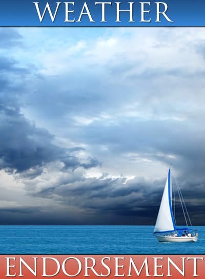
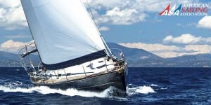
ASA 119, Marine Weather Endorsement
Able to observe and forecast weather conditions using traditional maritime skills and modern technology. Knowledge of weather information for planning and adapting navigation during short duration and extended voyages.
KNOWLEDGE
Basic Concepts
1.Describe the role of marine weather in boating plans, particularly wind forecasting.
2.Describe the relationship of temperature, precipitation, visibility, wind, and waves and their impact on forecasting.
3.Describe wind terminology and units used in speed, distances, temperatures and pressures.
4.Utilize data from the Ocean Prediction Center, National Data Buoy Center, and Marine National Weather Service (NWS) Charts.
Pressure and Wind
5.Describe the relationship between pressure and wind, including the flow of wind around highs, lows, ridges and troughs.
6.Convert apparent wind to true wind.
7.Calibrate and take readings from aneroid and digital barometers.
8.Describe pressure distributions and related labeling practices on weather maps.
9.Predict wind speed and direction from isobars on a weather map.
Global Winds and Currents
10. Describe the basic properties of the atmosphere and its influence on wind and weather.
11. Describe basic air mass classifications and vertical stability.
12. Describe the role of equatorial heating in establishing the doldrums, horse latitudes, trade winds and prevailing westerlies.
13. Describe the role of the poles in generating low fronts, and how these subsequently cross the mid-latitudes of the globe.
14. Describe the origins and behavior of winds aloft and how they contribute to the development and transport of surface systems around the globe.
15. Describe the distribution of ocean currents around the globe and how to predict their values for the purpose of voyage planning.
Strong Wind Systems
16. Describe forecasting conventions and warnings available for strong wind systems.
17. List the distinctions between lows and fronts, and between tropical and extra-tropical storms.
18. Describe how to predict squall behavior.
19. Describe how to find and using satellite wind measurements.
20. Describe typical behaviors of tropical depressions, storms, and hurricanes.
Clouds, Fog, and Sea State
21. Describe and identify 10 basic cloud types and what they might indicate.
22. Describe the sequence of clouds expected during a frontal passage.
23. Describe how fog forms and how it is forecasted.
24. Describe the practical distinctions between sea fog and radiation fog and between swells, wind waves and ripple.
25. Describe how to predict wave height and speed based on wind speed, duration, and fetch.
26. Describe the Beaufort Wind Force scale that relates wind speed to sea state.
Wind and Terrain
27. Describe how the presence and topography of land affects wind flow over adjacent waters.
28. Describe prominent local winds such as: sea breezes, land breezes, channeling & gap winds, blocking & lifting, and downslope winds.
29. Describe the interaction between thermal winds and pressure system winds.
Weather Maps
30. List types of weather maps available and how to access them at home and underway.
31. Describe the process of weather routing, including sequencing of analyses and forecasts to confirm forecasts.
32. Describe how to access and use GRIB forecasts, taking into account their pros and cons compared to analyzed products prepared by meteorologists.
33. Describe how to use the 500-mb maps and weather discussions to help evaluate surface forecasts.
34. Describe how to use shipboard observations of wind and pressure to evaluate analyses and the subsequent forecasts.
Sources of Weather Data
35. Compare the use of both traditional and modern sources of climatic data for planning the time and route of voyages – for inland and coastal voyaging, as well as ocean crossings.
36. List sources for weather data underway and wireless options for obtaining it.
37. Describe the distinctions and pros and cons of commercial weather services compared to free public services from the NWS.
38. Describe the role of professional weather routing services and how they might fit into voyaging plans.
On-board Forecasting and Tactics
39. Describe the proper use of barometer, wind speed, wind direction, clouds, and sea state for shipboard forecasting.
40. Describe how to gauge the direction of winds aloft from cirrus cloud patterns.
41. Give examples of maritime weather proverbs and which ones have value in forecasting.
42. Describe the role of weather routing in improving sailing tactics.
Southern Hemisphere Weather
43. Describe unique aspects of Southern Hemisphere weather.
44. List sources for weather information specific to the Southern Hemisphere.
ASA Certified Sailing Schools
There are 25 ASA Certified Sailing Schools that teach ASA 119, Marine Weather Endorsement
Show List Of Schools
Anchors Aweigh Sailing School New London, Connecticut
 (860) 514-0137 anchorsaweighsailing.com

At Anchors Aweigh, we believe sailing is a passion; it is more than boating, it is a connection with the wind and the water. We can help you reach your sailing goal, whether it be to sail on your local lake, spend a day on the Long Island Sound, race in regattas, or sail to the Bahamas.
Aoki Yacht School Sennan-gun, Japan
072-465-8192 aoki.us
As an American Sailing Association affiliate our courses are designed to give students internationally recognized ASA certification for the various levels of achievement. Successful completion of these courses qualify students to operate boats and equipment as outlined. The classes listed on this page are being offered from our beautiful Osaka bay location. Aoki School is also a government certified boat license school for the class 1 and class 2. We offer in-house trainings and exams. You don’t have to take Government tests any more. The classes for the Japan Boat License of the Class 1 grade lesson and the Class …
Austin Yacht Club Austin, Austin Area, Texas
(512) 266-1336 www.austinyachtclub.net
Aventura Sailing Academy Dana Point, Southern California
(949) 493-9493 aventurasailing.com
Aventura Sailing Academy is Dana Point Harbor’s Premier Sailing Club and Academy. For over 44 years we have been successfully teaching students, from the beginner to the advanced. We are a West Coast leader in producing well trained Sailors.
USCG Master Class 100T Captain Ric Dahlin (Director of Academy) is also a Collegiate level sailing instructor, and as a professional educator, Aventura’s classroom and lectures have been providing “best in class” sailing instruction with top results. All of our Certified ASA instructors are friendly and dedicated to your sailing instruction. Aventura Academy’s classes are challenging, fun and engaging but most importantly highly effective.
BE-Nautical Wilmette, Illinois
(847) 917-7245 www.BE-Nautical.com

Learning is a continuum. At BE-Nautical we seek to understand your educational and sailing goals to provide a curriculum rich with learning. Learn individually, as a couple or as a family – BE-Nautical has a course of learning to meet your specific sailing goals and needs.
Bluewater Sailing Marina del Rey, Southern California
(310) 823-5545 bluewatersailing.com
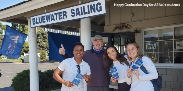
Sailing lessons in Marina del Rey, the Pacific Ocean and beyond. In addition to our ASA courses, we offer year-round innovative sailing possibilities that are tons of fun with many opportunities to get out on the water and meet others in our vast community of sailors with all levels of experience.
Delmarva Sailing School Rock Hall, Maryland
(410) 810-4230 delmarvasailingschool.com
Delmarva Sailing School operates on the Chesapeake Bay from May-October. We run as Virgin Islands Sailing Academy in Saint Thomas, US Virgin Islands from December-April, with the same great sailboat and instructors. We also teach Ocean Passage Making, as we move our teaching vessel in between the Chesapeake Bay and Saint Thomas.
Island Cruising Sidney, Canada
(250) 656-7070 www.islandcruising.ca
Fun, Learning and Safety! We teach from sailing fundamentals to Offshore . We are experienced sailors and our Outstanding ASA Instructors know how to tune in to each sailor’s individual learning style.
Naos Yachts Marina del Rey, Southern California
(310) 821-8446 naosyachts.com
The Naos Yachts team consists of offshore, coastal and dinghy racers, as well as long distance cruisers. Our instructors are all ASA certified and we provide instruction on brand new Beneteau yachts and Lagoon catamarans.
Nockamixon Sailing School Quakertown, Pennsylvania
(215) 499-0335 nockamixonsailingschool.com

We teach and certify our students to ASA standards, and offer beginning and intermediate level sailing classes. By choosing Nockamixon Sailing School for your sailing education you can realize your dream of learning to sail. Our alumni charter sailboats in destinations all over the world, and many have purchased their own sailboat.
North Shore Reaching Carrying Place, Canada
(905) 259-7572 www.northshorereaching.ca

North Shore Reaching Sailing School is the premier American Sailing Association certified school in Canada, established in 2017 with courses tailored to meet each individual’s needs with flexible day, evening and weekend scheduling, on our boat or yours. We are ideally situated on Eastern Lake Ontario with access to a variety of cruising grounds including The Bay of Quinte and The Thousand Islands.
Northern Breezes Sailing School – Minneapolis Minneapolis, Minnesota
(763) 542-9707 NorthernBreezesSailing.com

Norton’s Sailing School Deltaville, Virginia
(804) 776-9211 www.nortonyachts.com

Norton’s Sailing School provides students with top-notch sailing instructors who love the water and think the Bay is the best classroom. We believe that students learn best when 90% of the instruction is on the water. Our instruction is comprehensive, yet relaxed because we want our students to have fun while learning to sail!
Passion Yachts Portland, Oregon
(503) 289-6306 www.passion-yachts.com

Passion Yachts teaches on modern Beneteau, Jeanneau, and Hunter sailboats on the Columbia River and throughout the San Juan Islands. Boat sizes range from 22 to 45 feet. Passion Yachts will even teach students on their own boat if it is properly equipped. “Hands-on instruction” is paramount in Basic Sailing through Advanced Coastal Cruising. We believe that students learn best when 60%-90% of the instruction is on the water.
R&R Charters and Sail School Grasonville, Maryland
(570) 690-3645 randrchartersandsailschool.net
We own three boats, a Cal 22, a Hunter 28, and a new Beneteau Oceanis 41 for our 104 and 106 classes. Our beginning courses are taught over three days in the peaceful Chester River just off the Chesapeake Bay. For our 104 class we explore the calm rural anchorage areas of the Eastern Shore and visit Annapolis. Our 106 class does a Delmarva circumnavigation of approximately 450-500 nm with lots of night and ocean sailing experience.
Sail Solomons Solomons, Maryland
(410) 326-4917 sailsi.com

Our racing and cruising and chartering experience enables us to target the training to our student’s particular requirements. We truly love our jobs, but we take our sailing seriously so you will be safe on the water.
SailTime Chesapeake Bay South Norfolk, Virginia
(757) 480-7245 sailtime.com/virginia
If sailing the Chesapeake Bay is your dream, we are here to get you on the water. SailTime Chesapeake Bay South is located at Morningstar Marina on Little Creek in Norfolk, VA. We offer courses to get you on the water fast with comprehensive hands-on training in a fun relaxing 2-day course.
Sea Safaris Sailing School – Milwaukee Milwaukee, Wisconsin
(800) 724-5272 seasafarissailingschool.com

At Sea Safaris Sailing School, We prepare our students on how to become safe sailors by learning basic skills and best practices on the water. All of our fun filler courses start with the basics and elevate your skills to the next level. We believe learning is a continuum as many students start with basic sailing and keep improving to learn more advanced skills such as coastal navigation, celestial navigation, and marine weather.
Seattle Sailing Club Seattle, Washington
(206) 782-5100 seattlesailing.com
Seattle Sailing Club is the home of fun, affordable sailing on the Puget Sound. As one of the most active and vibrant ASA certification schools in the country, our experience teaching sailing is second to none. The priorities for each course are simple: Safe, Fun, and Professional. Our staff of well-qualified sailing instructors are licensed through the U.S. Coast Guard and American Sailing Association, and more importantly are committed to helping you achieve your sailing goals.
South Coast Sailing Adventures Seabrook, Houston / Galveston Area, Texas
(281) 334-4606 www.southcoastsailing.com
South Coast Sailing Adventures is conveniently located in Kemah, Texas – 30 minutes from downtown Houston or Galveston. All of our instructors are U.S.C.G. licensed captains and are certified by the ASA. We utilize training boats specifically designed to teach beginning sailors and we have the largest sailing fleet along the northern Gulf Coast with 24+ boats ranging from 23-45′ from manufacturers like Colgate, Catalina, Beneteau, and Hunter.
Spinnaker Sailing – San Francisco San Francisco, Northern California
(415) 543-7333 www.spinnaker-sailing.com
Spinnaker Sailing has been in business for 35 years. and is located in one of the Best Marinas on the West Coast, South Beach Harbor. This location is perfect as the breeze is fresh, the water is flat and it’s only 3 minutes from the boats berth to our teaching grounds…no long channels.
Starpath School of Navigation Seattle, Washington
(206) 783-1414 Starpath.com

Starpath School of Navigation is a world leader in marine navigation and weather training. We are a unique resource with over 18 years’ experience in online teaching. Our courses are guaranteed to make your time on the water safer and more enjoyable.
Tradewinds Sailing School & Club Richmond, Northern California
(510) 232-7999 www.tradewindssailing.com

Tradewinds Sailing School has a program for sailors at any level who are serious about gaining the foundation knowledge of sailing and continuing on to become a competent sailor.
Virgin Islands Sailing Academy Red Hook, US Virgin Islands, US Virgin Islands
(340) 690-6011 virginislandssailingacademy.com
All of our sailing classes are taught in a 3-9 day, live aboard approach, where students are totally immersed into learning to sail and cruise, and no hotels are required. Class size is kept small and is typically 3-4 students. Visit exotic destinations in Tortola, Jost van Dyke, Virgin Gorda, St. John, and St. Thomas while taking beginner to intermediate level sailing classes. Visit St. Croix, Anegada, Vieques, and Culebra in advanced classes.
Windward SeaVenture Charters Kemah, Houston / Galveston Area, Texas
(281) 467-2279 www.windwardseaventure.com
Windward SeaVenture Charters has instructors voted “Instructor of the Year” in 2002, 2005, 2006, 2013 and they all are USCG Master Level licensed captains with over 30 years’ experience in sailing and teaching. We also offer you a discount on all charters you take with us for 1 year from your date of completion of any class with no monthly club dues or yearly fees. Our class sizes are limited to 4 persons plus instructor, so that you will have individual attention.
Recommended Endorsements
Once you have passed your ASA 119, Marine Weather Endorsement you may find the following Endorsement Courses to be beneficial
Learn basic docking skills for boats with single inboard or outboard engines. Discover the basic theory and hands-on techniques needed to dock and undock boats in an efficient manner and without damage or injury.
Learn to properly use small-craft radar (or radar simulator) for piloting, navigation, and collision avoidance. Knowledge of radar principles and practical matters of radar operation.