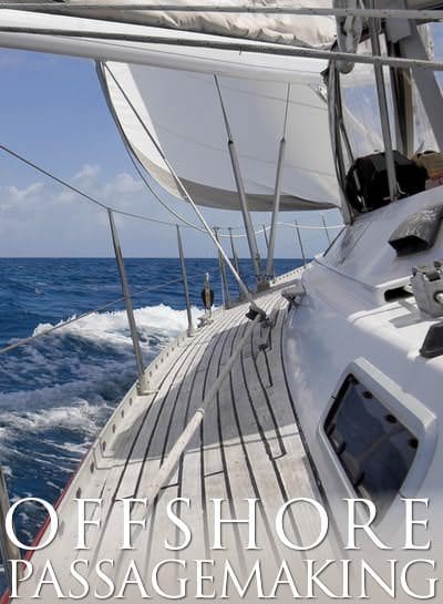
ASA 107, Celestial Navigation
Able to apply celestial navigation theory and practices for safe navigation of a sailing vessel in offshore waters. On-water celestial navigation skills elements are demonstrated in ASA 108, Offshore Passagemaking.
| Study Materials |
|---|
KNOWLEDGE
1. Convert longitude into time.
2. Convert standard time and zone time to GMT and vice versa.
3. Calculate the zone time given longitude.
4. Calculate the chronometer (or watch) error given a previous error and the daily rate.
5. Apply the corrections for index error, dip of the horizon, and total correction to convert sextant altitudes of the sun, stars, planets, and moon to true altitudes.
6. Calculate the time of meridian passage of the sun and calculate the boat’s latitude from the observed meridian altitude of the sun.
7. Determine the latitude at twilight by means of the Pole Star.
8. Solve the navigational triangle using a navigation table and show all appropriate work.
9. Plot celestial lines of position on a Mercator projection or on a universal plotting sheet.
10. Calculate the times (ship’s and GMT) of sunrise, sunset and twilight.
11. Determine the approximate azimuths and altitudes of the navigational stars and planets at twilight.
12. Calculate and plot the lines of position obtained from observations of several celestial bodies at twilight and thus find the boat’s position.
13. Advance the LOP obtained from a sun sight to another LOP obtained from the sun at a later time and find the boat’s position using a running fix (sun-run-sun).
14. Calculate the true bearing of a low altitude celestial body in order to determine the error and deviation of the compass.
ASA Certified Sailing Schools
There are 36 ASA Certified Sailing Schools that teach ASA 107, Celestial Navigation
Show List Of Schools
American Maritime Academy – Cairo Cairo, Egypt
+2-01116610222 ama-eg.com
The American Maritime Academy was established in 2006 to provide a maritime educational program that is both in-depth and accessible to the average mariner whose aspirations revolve around power-boat and sailboat handling. Our strategic uniqueness in the Middle-East stems from the lack of comparable establishments, which cater to the booming yachting industry in the twelve Arab countries of the region.
Anchors Aweigh Sailing School New London, Connecticut
 (860) 514-0137 anchorsaweighsailing.com

At Anchors Aweigh, we believe sailing is a passion; it is more than boating, it is a connection with the wind and the water. We can help you reach your sailing goal, whether it be to sail on your local lake, spend a day on the Long Island Sound, race in regattas, or sail to the Bahamas.
Aoki Yacht School Sennan-gun, Japan
072-465-8192 aoki.us

As an American Sailing Association affiliate our courses are designed to give students internationally recognized ASA certification for the various levels of achievement. Successful completion of these courses qualify students to operate boats and equipment as outlined. The classes listed on this page are being offered from our beautiful Osaka bay location. Aoki School is also a government certified boat license school for the class 1 and class 2. We offer in-house trainings and exams. You don’t have to take Government tests any more. The classes for the Japan Boat License of the Class 1 grade lesson and the Class …
Aventura Sailing Academy Dana Point, Southern California
(949) 493-9493 aventurasailing.com
Aventura Sailing Academy is Dana Point Harbor’s Premier Sailing Club and Academy. For over 44 years we have been successfully teaching students, from the beginner to the advanced. We are a West Coast leader in producing well trained Sailors.
USCG Master Class 100T Captain Ric Dahlin (Director of Academy) is also a Collegiate level sailing instructor, and as a professional educator, Aventura’s classroom and lectures have been providing “best in class” sailing instruction with top results. All of our Certified ASA instructors are friendly and dedicated to your sailing instruction. Aventura Academy’s classes are challenging, fun and engaging but most importantly highly effective.
Barefoot Offshore Sailing School (BOSS) Kingstown, Saint Vincent and the Grenadines
(784) 456-9526 barefootoffshore.com
Barefoot Offshore Sailing School (B.O.S.S.) is the longest-established (more than 20 years) and most active American Sailing Association (ASA) sailing school in the south-eastern Caribbean. BOSS is a subsidiary of Barefoot Yacht Charters, owned and run by folks who have been sailing and living here for more than 3 generations, and this gives us the unusual advantages of insight and local knowledge that most charter companies, no matter how experienced, simply cannot offer.
BE-Nautical Wilmette, Illinois
(847) 917-7245 www.BE-Nautical.com

Learning is a continuum. At BE-Nautical we seek to understand your educational and sailing goals to provide a curriculum rich with learning. Learn individually, as a couple or as a family – BE-Nautical has a course of learning to meet your specific sailing goals and needs.
Blue Pacific Yachting Marina del Rey, Southern California
(310) 305-7245 bluepacificyachting.com
Let Blue Pacific Yachting help you realize the joys of sailing. Learn to sail in a safe and supportive environment under the expert guidance of our certified instructors. Students gain hands-on experience and acquire the knowledge and confidence to sail aboard a modern, mid-sized, fully-equipped yacht.
Blue Water Sailing School Fort Lauderdale, South East Florida
(954) 763-8464 bwss.com
Sailing Education is All We Do We are exclusively a sailing school. One hundred percent of our efforts are devoted to sailing education and training. Many other schools are adjuncts of charter companies, whose primary goal is to drive as many people as possible to their charter fleet. Widely Recognized for Excellence We were recently ranked by readers of Practical Sailor magazine as one of the best sailing schools in the United States, and we were the highest rated American Sailing Association (ASA) school in their survey. We received ASA’s annual Outstanding School award (Southeast Region) in 2000, 2001, 2002, …
Bluewater Sailing Marina del Rey, Southern California
(310) 823-5545 bluewatersailing.com
Sailing lessons in Marina del Rey, the Pacific Ocean and beyond. In addition to our ASA courses, we offer year-round innovative sailing possibilities that are tons of fun with many opportunities to get out on the water and meet others in our vast community of sailors with all levels of experience.
Delmarva Sailing School Rock Hall, Maryland
(410) 810-4230 delmarvasailingschool.com
Delmarva Sailing School operates on the Chesapeake Bay from May-October. We run as Virgin Islands Sailing Academy in Saint Thomas, US Virgin Islands from December-April, with the same great sailboat and instructors. We also teach Ocean Passage Making, as we move our teaching vessel in between the Chesapeake Bay and Saint Thomas.
Delta Sailing School Isleton, Northern California
(916) 966-1855 deltasailingschool.com
Delta Sailing School offers classes and club membership in the beautiful, laid back, natural environment of the spectacular California Delta. With over 1,000 miles of waterway, we have lots of space for sailing and enjoying this peaceful gem that not too many people have discovered yet. We are convenient to Sacramento, the Foothills, the Valley and the San Francisco Bay Area. Learn to sail in steady winds and warm temperatures. Our instructors are enthusiastic and supportive, professional, experienced and fun. They love to teach sailing, and it shows! Our Basic Keelboat Class is limited to four students giving each person …
Fair Winds Sailing Greece Corfu Town, Greece
(+30) 6932755635 fairwindssailinggreece.com
Fair Winds Sailing Greece is located in Corfu Island – one of the finest destinations in the Med with lots of sailing options in the Ionian Sea. The west Greek mainland and the Ionian Islands form an extensive coastline that provides countless protected bays and beaches of rare beauty, ideal for swimming, snorkeling and scuba diving.
Flagship Sailing School Ruskin, Central West Florida
(727) 946-6542 www.flagshipsailing.com
Freeman Marine Institute Newport Beach, California
(916) 792-8478

Freeman Marine Institute is devoted to excellence in teaching, learning, and helping students gain access to the amazing world of Sailing.
Island Cruising Sidney, Canada
(250) 656-7070 www.islandcruising.ca

Fun, Learning and Safety! We teach from sailing fundamentals to Offshore . We are experienced sailors and our Outstanding ASA Instructors know how to tune in to each sailor’s individual learning style.
Marina Sailing – Channel Islands Oxnard, Southern California
(805) 985-5219 www.marinasailing.com
Marina Sailing is Southern California’s oldest and largest sailing charter and instruction company. Started in 1962, our six locations along the coast offer a wide range of boats from 22 to 50 feet, including monohulls, catamarans, and powerboats.
Maryland School of Sailing Rock Hall, Maryland
(410) 639-7030 mdschool.com

At the Maryland School of Sailing and Seamanship, helping people become exceptional sailors is our passion. That’s why our reputation as a serious school for serious sailors follows our students wherever they go. We don’t cut corners or compromise safety to sell certifications. We simply offer the best sailing instruction and turn out the finest sailors found anywhere. Since 1991, we’ve completed more than 240 long distance ocean training cruises and are known worldwide for our advanced program. However, like all pursuits, achieving a standard of excellence requires a thorough mastery of basic skills, and this is what we do …
Modern Sailing School & Club Sausalito, Northern California
(415) 331-8250 modernsailing.com

Since 1983, Modern Sailing School & Club has been introducing people to sailing from our headquarters in Sausalito, California. Even if you have never set foot on a boat, we can teach you everything you need to know to build a strong foundation in this rewarding and life long sport.
Nockamixon Sailing School Quakertown, Pennsylvania
(215) 499-0335 nockamixonsailingschool.com

We teach and certify our students to ASA standards, and offer beginning and intermediate level sailing classes. By choosing Nockamixon Sailing School for your sailing education you can realize your dream of learning to sail. Our alumni charter sailboats in destinations all over the world, and many have purchased their own sailboat.
Northern Breezes Sailing School – Minneapolis Minneapolis, Minnesota
(763) 542-9707 NorthernBreezesSailing.com

Puget Sound Sailing Institute Tacoma, Washington
253-383-1774 pugetsoundsailing.com

PSSI has one of the most complete and varied programs in the country. Classes can be taken in challenging Puget Sound or on one of our Exotic Sailing Vacations in the Caribbean, Sea of Cortez, South Pacific or Greek Islands!
R&R Charters and Sail School Grasonville, Maryland
(570) 690-3645 randrchartersandsailschool.net
We own three boats, a Cal 22, a Hunter 28, and a new Beneteau Oceanis 41 for our 104 and 106 classes. Our beginning courses are taught over three days in the peaceful Chester River just off the Chesapeake Bay. For our 104 class we explore the calm rural anchorage areas of the Eastern Shore and visit Annapolis. Our 106 class does a Delmarva circumnavigation of approximately 450-500 nm with lots of night and ocean sailing experience.
Sail Dallas Dallas, Dallas / Ft. Worth Area, Texas
(214) 215-7245 www.saildallas.com
Mastering the sport of sailing requires a knowledge of sailing techniques, safety procedures, and, most importantly, actual sailing experience. We are leaders in promoting safe, competent boating. We are, and always have been, the Metroplex’s premier sailing school. Our curriculum has been developed over many years of experience in teaching and our program continues to set the standard. From time to time, you may notice other sailing schools attempting to emulate our program. Remember, at their best, they will only be as good as we were last year. If you are not willing to settle for second best, seek out …
Sail Hawaii Honolulu, Hawaii
(808) 859-3875 www.sail-hawaii.com
Aloha! Sail Hawaii offers beginner to advanced sailing and navigation instruction and private sailing cruises to visitors and kama’aina in the beautiful waters of Hawai’i. Day sailing and live aboard courses are taught by professional and experienced instructors, both in a comfortable classroom and with practice aboard our classic style sailboats. Our courses are regularly scheduled and affordably priced for individuals and small private groups.
Sail Solomons Solomons, Maryland
(410) 326-4917 sailsi.com

Our racing and cruising and chartering experience enables us to target the training to our student’s particular requirements. We truly love our jobs, but we take our sailing seriously so you will be safe on the water.
Sonset Sailing School Port Sanilac, Michigan
(989) 635-2696 sonsetmarine.com
Located in the summer vacation resort village of Port Sanilac, we can certify you and prepare you for your next sailing adventure. Capt’n John Diel has over 40 years of sailing experience and almost 100,000 miles of sailing logged. He has sailed and trained many for family adventures and for long distance blue water passage making. He is a “Salty Dog” – a title given by ARC to those who have sailed many miles and ocean passages.
South Coast Sailing Adventures Seabrook, Houston / Galveston Area, Texas
(281) 334-4606 www.southcoastsailing.com
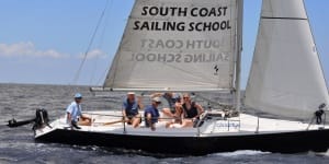
South Coast Sailing Adventures is conveniently located in Kemah, Texas – 30 minutes from downtown Houston or Galveston. All of our instructors are U.S.C.G. licensed captains and are certified by the ASA. We utilize training boats specifically designed to teach beginning sailors and we have the largest sailing fleet along the northern Gulf Coast with 24+ boats ranging from 23-45′ from manufacturers like Colgate, Catalina, Beneteau, and Hunter.
Spinnaker Sailing Redwood City, Northern California
650-363-1390 spinnakersailing.com

Spinnaker Sailing in Redwood City is the perfect sailing club providing, sailing instruction and sailing activities for those living on the San Francisco Peninsula, South Bay and East Bay locations. Students who graduate from Spinnaker Sailing School not only received the internationally recognized certification from ASA but the confidence to sail anywhere in the world.
Starpath School of Navigation Seattle, Washington
(206) 783-1414 Starpath.com

Starpath School of Navigation is a world leader in marine navigation and weather training. We are a unique resource with over 18 years’ experience in online teaching. Our courses are guaranteed to make your time on the water safer and more enjoyable.
Tradewinds Sailing School & Club Richmond, Northern California
(510) 232-7999 www.tradewindssailing.com

Tradewinds Sailing School has a program for sailors at any level who are serious about gaining the foundation knowledge of sailing and continuing on to become a competent sailor.
Victoria Sailing School Denver, Colorado
(303) 697-7433 www.victoriasailingschool.com
The Victoria Sailing School is Colorado’s oldest and largest sailing school. Since its founding in 1986, we have trained thousands of students from the Rocky Mountain area. We are dedicated to providing the highest quality product. Our courses range from introductory sailing classes through Coastal and Celestial Navigation, for those wishing to fulfill their ultimate dream. There is an old expression about learning how to sail “The Fastest Way to Learn How to Sail – Start in the Smallest Boat in the Coldest Water”. We do not take this expression to extremes, but the J/22 offers an exceptional sailing experience …
Virgin Island Sailing School St. Thomas, US Virgin Islands, US Virgin Islands
(805) 850-8135 sailusvis.com

In the Caribbean, the water is 78-82 and air, about the same with 10-15 knot breezes 340 days a year. We are based in St Thomas (which is more economical to fly in to) but spend most of our time island hopping in the BVIs. With so many islands, the majority of ocean swells are block making for fast, comfortable sailing. Students are limited to 6 per class and matched to our small but outstanding group of highly experienced instructors.
Virgin Islands Sailing Academy Red Hook, US Virgin Islands, US Virgin Islands
(340) 690-6011 virginislandssailingacademy.com
All of our sailing classes are taught in a 3-9 day, live aboard approach, where students are totally immersed into learning to sail and cruise, and no hotels are required. Class size is kept small and is typically 3-4 students. Visit exotic destinations in Tortola, Jost van Dyke, Virgin Gorda, St. John, and St. Thomas while taking beginner to intermediate level sailing classes. Visit St. Croix, Anegada, Vieques, and Culebra in advanced classes.
West Coast Multihulls San Diego, Southern California
(619) 365-4326 charter-catamaran.com

Catamarans and trimarans are not just another income stream for West Coast Multihulls, they are our passion. If your sailing goal is to become a proficient confident multihull sailor, we are the school for you. Our staff and Instructors have decades of multihull, training, sailing and live-aboard experience to draw from and share with you. We sail out of beautiful San Diego, CA with sailing classes offered year-round from the Sunroad Resort Marina. San Diego enjoys a comfortable, moderate climate with light to moderate winds throughout the year. We are the only catamaran and trimaran specialists in California. West Coast …
Windsong Sailing Academy Lake Lanier, Georgia
(770) 967-1515 windsongsail.com
Windward SeaVenture Charters Kemah, Houston / Galveston Area, Texas
(281) 467-2279 www.windwardseaventure.com
Windward SeaVenture Charters has instructors voted “Instructor of the Year” in 2002, 2005, 2006, 2013 and they all are USCG Master Level licensed captains with over 30 years’ experience in sailing and teaching. We also offer you a discount on all charters you take with us for 1 year from your date of completion of any class with no monthly club dues or yearly fees. Our class sizes are limited to 4 persons plus instructor, so that you will have individual attention.
What's Next?
Congratulations! You passed your ASA 107, Celestial Navigation so which ASA certifications should you take next?
Learn to skipper a sailing vessel on extended offshore passages requiring celestial navigation. Knowledge of long-term passage planning, offshore vessel selection, sail repair, offshore first aid, watch-keeping, emergency procedures, abandon ship protocols, safety and seamanship.